The Digital Twin provides 3D and 4D visualisations of future planning scenarios.

The Digital Twin provides 3D and 4D visualisations of future planning scenarios.
Data counts. So do people.
The latest Australian geospatial event has finished, with next year’s event being announced.
By Paul Hemsley The Victorian government has moved to substantially broaden its collection of ‘open data’ available to industry and software developers by making more geospatial information available that pinpoints…
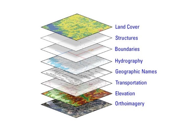
By Paul Hemsley Local governments across Australia have banded together to participate in a ground breaking new research project that will finally plot out how they collectively use Geographic Information…
Place-based policies and how they are linked to government service delivery to citizens in any location will be discussed at the spatial@gov Conference and Exhibition 2012. The event taking place…
The Department of Environment and Natural Resources (DENR) will use Esri Australia’s geospatial technology to produce a fire management plan for Cape Gantheaume on Kangaroo Island. Identifying bushfire risk is…