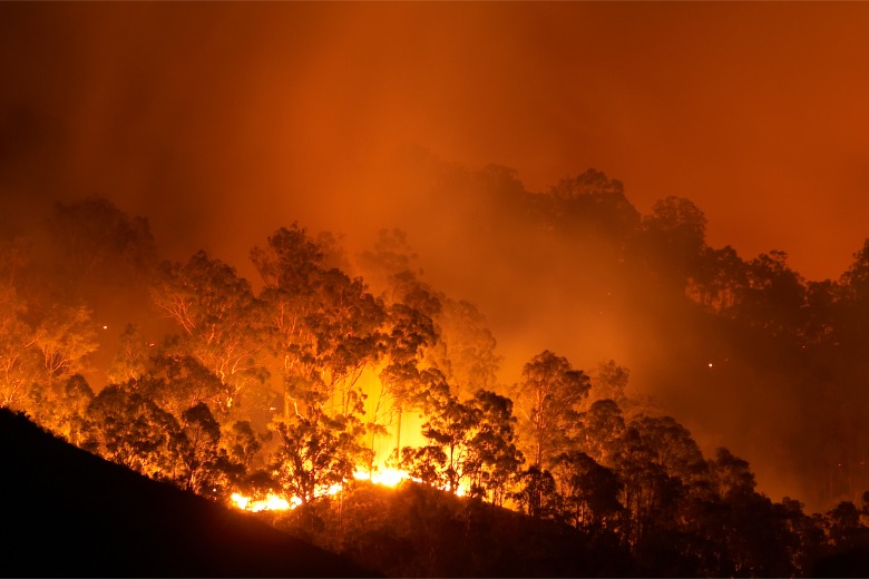
With warnings of a hot, dry weather pattern ahead, and the increased threat of bushfires, Australia needs to be ready to safeguard communities, ecosystems, agriculture and infrastructure through proactive and innovative strategies, writes Dan Paull.

To effectively evaluate, manage, and respond to the risks and challenges posed by a potential El Niño summer, Australian organisations and government agencies need to harness powerful geospatial data, insights, and cutting-edge tools such as artificial intelligence (AI) within geographic information systems.
The 2023 heatwave sweeping the northern hemisphere has broken temperature records going back as far as 1979. If that is a precursor for the upcoming Australian summer, our government agencies must be on the front foot. The first step is to proactively leverage technology, data and insights to be prepared with smarter infrastructure and environmental protection planning.
Powering environmental protection with location intelligence
Location intelligence has the potential to significantly enhance disaster preparation, helping authorities and environmental experts monitor changes in factors like vegetation, water levels, and land cover.
While traditional planning methods have relied on historical data and collective knowledge, geospatial imaging and datasets are revolutionising the way we approach disaster preparedness and resilience. Integrating AI and machine learning to quickly process vast amounts of data can generate valuable insights.
Armed with insights from aerial imagery, powered by AI, insurers and government agencies can quickly assess disaster impact remotely, on a large scale – from single properties to entire suburbs and regions. In a fraction of the time needed for traditional assessments, responders can be deployed, insurance claims finalised, and repairs and rebuilds instigated sooner to help restore communities.
The real-time view of vulnerable landscapes facilitates swift detection of anomalies and potential risks. This early warning system allows for timely interventions, reducing the severity of environmental impacts that natural disasters might inflict on vulnerable ecosystems.
Intelligent geospatial data for resilience and recovery
From the devastating Black Summer fires of 2019 to Australia’s worst and historically most expensive floods in 2022, many communities are still on the path to recovery. By harnessing aerial imagery, governments and organisations can optimise disaster impact assessments, resource allocation, and recovery operations.
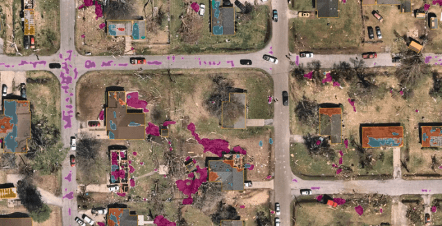
However, if there’s one key lesson from these disasters, it’s that timely and accurate information derived from location intelligence is key to restoring vital infrastructure, rebuilding communities and ultimately saving lives. Proactive insurance companies are already leveraging this technology to calculate damage and expedite claims remotely, without needing to send assessment teams into potentially dangerous or hard-to-reach disaster zones.
While government agencies have the responsibility to safeguard communities and our natural environment from the increasing threats posed by El Niño and its related impacts, this requires a collaborative, concerted effort.
Embracing the power of location intelligence such as high-resolution aerial imagery and AI data as a tool for disaster preparedness and recovery will give Australia more effective and resilient disaster governance.
By harnessing the insights provided by this technology, I look forward to seeing how government agencies and disaster organisations can better anticipate, respond to, and help us recover from weather events, ultimately ensuring the safety and prosperity of our communities.
*Dan Paull is Executive Vice President & General Manager Australia and New Zealand, Nearmap
Comment below to have your say on this story.
If you have a news story or tip-off, get in touch at editorial@governmentnews.com.au.
Sign up to the Government News newsletter
One thought on “How location intelligence can prepare Australia for El Niño”
Leave a comment:
Most read
CEO on leave as minister launches probe into council
Qld council welcomes progress on massive battery system
‘Local’ procurement turns out not to be so local, committee hears
MoG changes see regions, investment return to NSW Premier’s Department
15 councils participate in SA emissions reduction trial
Satellite spotting of wild fires and dedicated quick response of aircraft water bombing as required, especially for remote locations should be a given.
The billions of dollars spent on fixing the damage of these fires and the CO2 reduction far exceeds the cost of this service.
Its time the government got on the ball with this.