The timing of Australia’s often epic floods and fires has historically been a guessing game, but federal state and local councils are increasingly turning to Geographic Information System (GIS) technology to far more accurately predict and plan for disasters and manage ensuing emergency responses.
Just a few years ago so-called smart maps that mash together multiple and sometimes real time data sources were regarded a nascent technology within the public sector, but a series of powerful lessons learned quickly on the job are set to propel the technology to almost mainstream status, not just at the height of emergencies, but well before they occur.
Esri Australia Business Solutions Manager Doug van Gelder said smart maps allowed people to drill down into multiple layers of data, such as historic flood and cyclone information, weather and wave reports and the condition of levy banks, to predict when a disaster might occur and to take steps to minimise its impact.
Maps can show the position of assets, such as ambulances and fire engines, and show where they should be located to protect people and infrastructure like hospitals, roads and substations. Information from smartphones can also be fed back into the system to track and mobilise key emergency response personnel, like medics. They can also save lives.
“In an emergency, smart mapping technology provides accurate on-the-spot analysis of the impact on assets in affected regions and allows for an immediate – and informed – response to urgent situations,” Mr van Gelder said.
“You can make decisions faster with less risk because you are sure of your information. It saves time and money and, in the worse-case scenario, lives.
He said the platform was capable of bringing in “pretty much any type of information” available and making it accessible in one, central place.
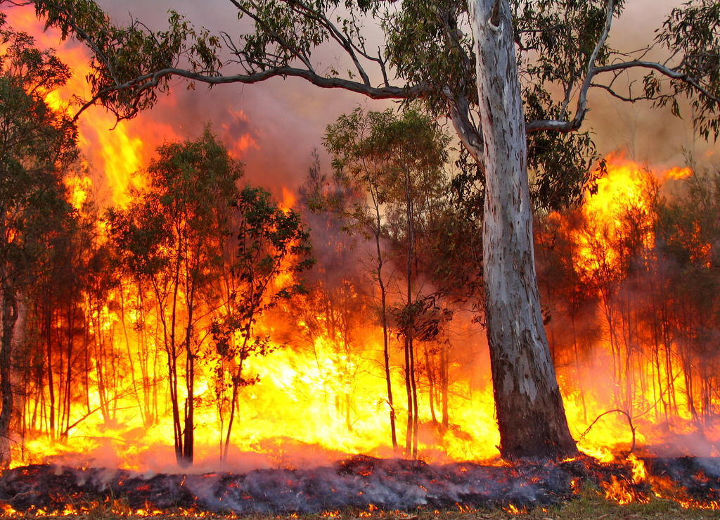
During the 2013 NSW bushfires an online interactive map, produced by Esri, kept the public informed about evacuation centres, air quality, traffic, emergency alerts, school closures and the status of bushfires using accurate data from the Rural Fire Service, the State Emergency Service, the Office of Environment and Heritage, NSW Department of Transport and other key government agencies.
The map featured real-time social media feeds, with geo-located Twitter updates providing eye-witness accounts as the disaster unfolded in affected areas.
GIS technology was also employed during the Queensland floods, the tsunami in Japan and Hurricane Sandy in the US.
Mr van Gelder said that any information, could be integrated into GIS platforms, whether inputted manually or by machine. For example, demographic information could show emergency planning teams where there were high concentrations of retired people or young families and these people could be given longer to evacuate during an emergency.
Commercial information is increasingly being fed into these platforms. For example, mining companies often have people on the ground that can spot bushfires, take photographs or monitor flood gauges and alert local councils using smartphones to convey their co-ordinates.
The same technology can also be used to co-ordinate rebuilding efforts after a disaster. After the 2011 Queensland floods, smart mapping highlighted areas worse hit by floods to plan rebuilding efforts and to chart the progress of repairs.
The New Zealand government and Christchurch City Council have used smart maps since the 2011 Christchurch earthquake to identify areas needing emergency relief and to plan and rebuild the city using 3-D images of what it could look like.
The technology is not just used to improve the response to emergencies and natural disasters, it can also be used to manage infrastructure like buildings, bridges, pipelines and roads and to track them assets across their entire lifecycle – from initial planning and acquisition to maintenance, operation, emergency responses and disposal.
For example, government-owned water authorities wanting to monitor the condition of their pipelines can feed information and photographs from manual pipe inspections or fixed cameras to find and repair leaks or replace valves.
“With these smart maps, asset managers can drill further down to other data sources such as pdf files that include user guides, maintenance records, repair records, inspection reports and the full history of each and every asset by simply clicking on an icon,” Mr van Gelder said.
“Currently, many facilities and assets are managed using tables and charts, which do not provide a clear visualisation of the significance of a certain location – a key contextual component when making critical business decisions about an asset’s value.”
The Department of Defence is currently using an Esri platform to map its bases and everything on them, e.g. vehicles, gardens, roads, accommodation and underground pipes.
Larger councils like Brisbane City Council use GIS to manage a complex portfolio of assets, whether they are fixed – like lamp posts and railway lines – or mobile – such as vehicles, iPads and iPhones. Councils can integrate systems such as asset management, finance and HR with an asset’s location.
“Governments are owners of an incredible array of assets, from mega-structures like buildings and bridges, to desks and chairs and devices like phones,” Mr van Gelder told Government News.
“Everything that the government owns automatically goes on an asset register to account for them and that information is linked to a location of where that building is or where that car is parked.
“It’s about enabling that information to be available in a location context so that CEOs’ or Director Generals can understand, for example, ‘how many vehicles do we have on the road at the moment?
“Ultimately, smart maps provide a common language for communication within an organisation to enhance decision-making, increase efficiencies and save money.”
Comment below to have your say on this story.
If you have a news story or tip-off, get in touch at editorial@governmentnews.com.au.
Sign up to the Government News newsletter