
Govt programs recognised for innovative use of GIS technology
Australian government agencies are using geospatial information technology to modernise services and operations.
13 July, 2023
Australian government agencies are using geospatial information technology to modernise services and operations.
13 July, 2023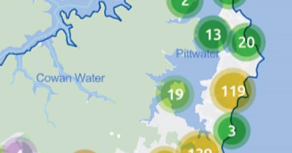
Northern Beaches Council wants an informed picture of the cultural and creative sector in its LGA.
11 November, 2021
Australian governments must share data to realise its potential as an operational and strategic asset.
14 November, 2018
Using mapping for disaster planning.
7 May, 2015
Resources handbook scoops GIS gong.
2 October, 2014
GIS to track government assets.
24 September, 2014
By Julian Bajkowski Police in South Australia are taking advice on how curb the state’s bike menace using digital mapping and geographic information systems to keep tabs on the two-wheeled hoodlums. The move to put bikies on the law enforcement map comes from US criminal profiler Mike King who works for GIS systems provider Esri […]
19 February, 2013
Mapping technology used in last year's Queensland flood disasters is being used to help South Australia’s Country Fire Service (CFS) volunteers. The CFS has been working with location intelligence vendor Esri Australia to develop a Geographic Information System (GIS) solution that uses multi-layered digital maps to provide front-line crews with detailed information as emergency […]
27 April, 2012
The Department of Environment and Natural Resources (DENR) will use Esri Australia’s geospatial technology to produce a fire management plan for Cape Gantheaume on Kangaroo Island. Identifying bushfire risk is a part of the plan, as well as providing strategies to minimise bushfire impact on the Cape Gantheaume reserve covering 37500 hectares, which experienced its […]
13 January, 2012End of content
No more pages to load
Michael Andjelkovic on: Council takes on NSW government in court
jdvukovic@bigpond.com on: Council takes on NSW government in court
Tyrone Peter Fernandes on: NSW announces biosecurity appointments