By Julian Bajkowski
Flood affected councils and residents in Queensland are hoping that a landmark deal brokered by the Newman Government to give insurers access to free flood map data will place heavy downward pressure on premiums that skyrocketed after successive floods.
Queensland Natural Resources and Mines Minister, Andrew Cripps, has announced that a much anticipated Memorandum of Understanding between the Queensland Government and peak body the Insurance Council of Australia (ICA) has finally been signed, a move that both parties hope will make cover easier, fairer and more affordable.
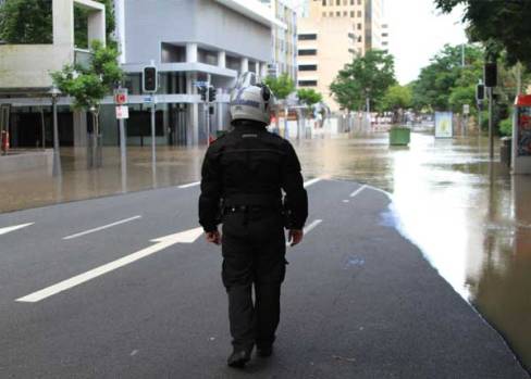
Insurers had been under sustained fire from several Queensland mayors over a series of large premium increases sheeted back to policy holders to take account of the risk of flooding that were sometimes applied indiscriminately to properties based on postcodes rather than elevation or other relevant topographical information.
In 2011 the Local Government Association of Queensland slammed claims from insurers that councils were withholding flood maps from insurers in an effort to deflect blame for the insensitive treatment of flood victims.
At the time the councils argued they created flood maps as a necessary resource for their own emergency response purposes – rather than as a free service to insurers.
Now Queensland’s State Government is clearly hoping that an opening of the flood data gates will prompt insurers to revisit and recalibrate steep premiums applied to those who really are left high and dry.
“Queensland has been challenged in recent years by a full range of natural disasters, including flooding, storms and cyclones, with greater frequency and intensity than neighbouring States,” Mr Cripps said.
“Insurance premiums have risen significantly in Queensland and have been fuelled by uncertainty about hazard areas and the ability of insured premises to withstand severe weather events.”
Mr Cripps said the new agreement with the ICA and the Queensland Department of Natural Resources and Mines (DNRM) would provide insurers “free access to all existing and future Queensland Government flood mapping and elevation data.”
“This will ensure premiums are calculated on the most up-to-date, accurate spatial data available,” Mr Cripps said.
“Insurance premiums hit hard on the back pocket of Queenslanders, particularly in the north, and I am pleased to see this MOU signed.
“In recent years we have been hit hard by Cyclones Larry and Yasi, along with several flood events, which have had a huge impact on communities,” Mr Cripps said.
After weathering flak from angry policy holders, councils and businesses insurers are understandably keen to play ball on the new sharing regime.
Insurance Council chief executive Rob Whelan said the Newman Government’s MOU helped “remove uncertainty by being open and transparent with insurance companies.”
“Sharing this important data will help the insurance industry deliver the most accurate and affordable premiums for policyholders and is positive for communities too,” Mr Whelan said.
“DNRM has given the insurance industry access to official flood data and mapping for the first time, as well as access to the Queensland Globe, which lets insurers analyse flood lines from the 2011 and 2013 flood events.
"Insurers will be able to use the latest data when calculating premiums for households and businesses in flood-prone regions. This is likely to reduce the upward pressure on premiums for many households,” Mr Whelan said.
Whether or not premiums will come down, and how far, remains to be seen.
Comment below to have your say on this story.
If you have a news story or tip-off, get in touch at editorial@governmentnews.com.au.
Sign up to the Government News newsletter
Related stories
-

Queensland councils increase Budget pressure
-
Councils rally to support flood-affected Queensland
-
Queensland councils seek $1b for flood-proofing
-
Queensland electoral system review
-
Queensland to upsize key dams and build new ones to mitigate future flood disasters
-
Queensland council plebiscites delayed