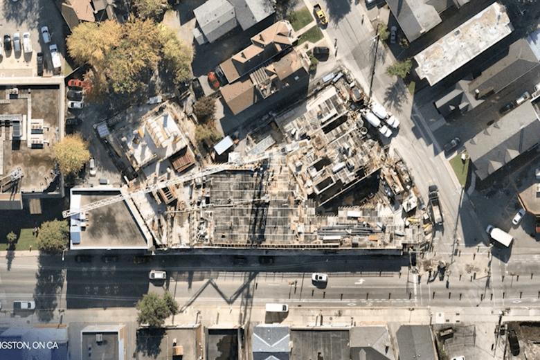
Artificial intelligence is transforming the geographic information systems (GIS) industry, a forum has heard.
AI uses processes like deep planning, post-processing algorithms and layers of machine learning to extract attributes from aerial data, such as road surfaces, solar panels, poles or construction equipment.
GIS technology is currently being used by government agencies, insurers, private business, researchers, disaster planners and even creatives.

Phil Healy, Manager of Enterprise GIS Services at City of Kingston in Ontario, Canada, has been using aerial mapping products supplied by Australian location data company Nearmap for planning, designing, building and asset maintenance.
Mr Healy says combining AI with GIS it will be a game changer, especially for asset management.
He says it will be able to identify the condition of roads, show where car parks are required, help identify where to put new 5G networking equipment, help clear canopies from powerlines and plan more efficient delivery of public services.
It will also help cities like Kingston plan for and adapt to change, including climate change, he said.
“That intersection of geospatial technology with AI and location, where AI and location and GIS start to come together, would certainly help optimise our data collection asset management process,” Mr Healey told a Nearmap customer forum this week.
“From a strategic perspective we see automation using AI as enabling the city to take a big leap forward in areas like enhancing service delivery, speeding up innovation and the introduction of new models for assets and facilities a management.
“I think that’s a game changer in the way we deliver our services.”
Value in the insights
Nearmap CTO Tom Celinski told the forum AI has the ability to give aerial geographical data instant value.
“The key thing isn’t to capture the data and stash it away but to make it accessible and instantly valuable,” he said.
The key thing isn’t to capture the data and stash it away but to make it accessible and instantly valuable
Tom Celinski
“The value’s in the insights and … the conversation you have with the data.
“What comes after AI is a full understanding of the world; quantifying and understanding what’s where and making it super easy to access.”
Nearmap, which was founded in Perth in 2008, is now onto its fourth generation AI system in 12 months and is offering 11 AI packs, a reflection of the speed at which the technology is evolving.
It is also currently working on new products including a new generation hyper-camera systems to capture images and an appraisals solution for government due to be released in coming weeks.
Comment below to have your say on this story.
If you have a news story or tip-off, get in touch at editorial@governmentnews.com.au.
Sign up to the Government News newsletter