A new geospatial tool has been released that’s designed help local governments plan for severe weather events, support recovery and expedite insurance claims.

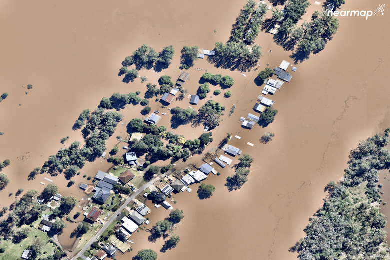
Aerial imagery and location analytics provider Nearmap is aiming to map every major natural disaster in the country that significantly impacts property, infrastructure and communities, including bushfires, cyclones, storms, hail, earthquakes, flooding and tsunamis.
It has already captured more than 6,200 square kilometres of disaster-affected land including the NSW floods, the Perth Hills fires and Cyclone Seroja in WA.
Nearmap managing director and CEO Rob Newman says the company is committed to covering an additional 15,000 square kilometres of disaster-affected land outside its regular capture program.
Nearmap says the information can help organisations asses damage, plan disaster responses and manage rebuilding and recovery, with its ImpactResponse tool providing city-scale aerial imagery and location data within days of a disaster.
The tool was developed in collaboration with government agencies and disaster relief organisations including Disaster Relief Australia.
Dr Newman says the new technology comes in response to the devastating 2019-20 Black Summer bushfires and the NSW floods.
“Our customers have told us aerial imagery, location intelligence and geospatial tools enable them to rapidly assess and understand the situation on the ground following natural disasters, at a time when ground access is limited, and inspection resources are stretched,” he said.
Disaster Relief Australia’s National Aerial Damage Assessment Team Manager Brent Hoad says access to fast, accurate and consistent data is crucial for disaster relief organisations as the country moves into the bushfire season.
“As natural disasters become more complex, unpredictable, and difficult to manage, we must take advantage of every available tool to help us plan for catastrophes and support those impacted,” he said.
Down the track Nearmap aims to also be able to capture areas at risk of future catastrophic events including climate change-related events.
Comment below to have your say on this story.
If you have a news story or tip-off, get in touch at editorial@governmentnews.com.au.
Sign up to the Government News newsletter
What about the greater MacArthur growth area bush fire evacuation plan. There is none. Thousands of lives at risk. Nobody cares.