Cardinia Shire Council in Victoria has used ground penetrating radar (GPR) to reduce tree removal during road construction.
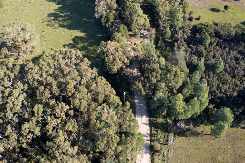
Cardinia Shire Council has partnered with Australian spatial data services provider Veris to survey and map underground tree root systems using 3D GPR technology and mobile laser scanning to capture an unsealed road corridor in 3D.
The technology, which has been trialled in the rural town of Nar Nar Goon in Gippsland as part of mandatory ecological investigations, aims to reduce vegetation loss, environmental impact and vegetation offset costs for road construction and upgrade works.
CEO Carol Jeffs says he’s proud to see Council using innovative, sustainable initiatives.
“Tree removal is often a regular part of construction and road projects, especially in Cardinia Shire,
where we are faced with dense bushland and scrub,” Mr Jeffs says.
“Over the last several years, we as a council, have been reviewing the way we go about our infrastructure projects, and have become more conscious of the long-term effects that these practices can have on our native vegetation and wildlife.
“Ground penetrating radar will allow us to conduct a non-invasive analysis of the tree roots and their
conditions below our roads, enabling us to plan accordingly and make adjustments where needed.”
Using a car equipped with the 2.4m wide radar, surveyors captured capture a complete image of the road surface and the surrounding area.
The GPR was set to detect tree roots up to 4m below the road surface and was accurate in detecting root depth by 50mm.
From the GPR data and footage, a 3D model showing the trees and their roots above and below
ground was created.
The model meant arborists and council officers could assess if road levels needed to be adjusted to avoid certain areas, and which tree roots could remain viable throughout construction.
It meant that fewer than 20 of the thousands of surrounding trees had to be removed.
Arborists estimate that more than 340 trees could potential have been removed if traditional surveying methods were used.
Council also estimates the technology saved them over $300k in tree removal costs.
Council is now rolling out the GPR surveys on other projects across the LGA.
Comment below to have your say on this story.
If you have a news story or tip-off, get in touch at editorial@governmentnews.com.au.
Sign up to the Government News newsletter