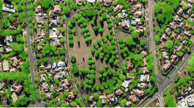
Accurate tree canopy maps enable targeted management strategies in Canberra.
In the leafy streets of a city like Canberra, a strong understanding of natural resources will prove invaluable for overcoming the challenges of climate change, sustainability and community expectations.
Transport Canberra and City Services (TCCS) recently engaged 1Spatial to analyse and extract aerial laser scanning data to accelerate the process of establishing baseline data for Canberra’s urban tree canopy coverage.
The resulting case study features TCCS and Safe Software’s FME custom workflow for canopy mapping. Using the method established, informative and current data sets can now be used to inform management strategies by overlaying age, density and condition data and proposing future canopy density targets.
The establishment of current baseline data for Canberra’s urban tree canopy coverage was essential to the program. In this respect, two data sets were available: a 2010 ground-based audit of trees in streets, verge areas, open spaces and parks; and new aerial laser scanning LiDAR (Light Detection And Ranging) data for the majority of urban areas across Canberra.
Read more here.
This story first appeared in Spatial Source.
Comment below to have your say on this story.
If you have a news story or tip-off, get in touch at editorial@governmentnews.com.au.
Sign up to the Government News newsletter
Related stories

Most read
CEO on leave as minister launches probe into council
Qld council welcomes progress on massive battery system
‘Local’ procurement turns out not to be so local, committee hears
MoG changes see regions, investment return to NSW Premier’s Department
15 councils participate in SA emissions reduction trial