One of Sydney’s most bushfire-prone LGAs has adopted a US-designed simulator used during the recent deadly California wildfires to inform the community about how fires can spread in their area and help them prepare for bushfire season.
Ku-ring-gai Council is the first local government in Australia to use the American-made Simtable tool, which gives 3D projections of how bushfires start and spread through the landscape calculated on wind speed, terrain, temperature and other factors.

Council was able to purchase the $70,000 tool with the help of a grant from the NSW Department of Environment, Energy and Science.
Dr Jenny Scott, Sustainability Program Leader for the council, says the tool will be helpful in demonstrating to the community how bushfires behave under various weather conditions.
“It allows us to demonstrate to people why these fires are, on those extreme weather days, so unpredictable and why they move so fast,” she told Government News.
Educating the community
The council has held a series of information sessions to unveil the new tool and educate the community.
“We’ve only had it for a couple of weeks, but what we’re already finding is that people are saying ‘I had no idea that could happen’,” Dr Scott said.
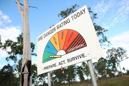
‘So they’re understanding that they need to prepare for an extreme event and not just rely on the fact that there was a hazard reduction burn fairly recently in their neighbourhood.”
Because of the way the fires behave, hazard reduction doesn’t make much difference, according to Dr Scott.
“What makes the difference is how robust their house is to ember attack and radiant heat, and how well prepared they are,” she said.
“We want them to be happy to leave their house early knowing that it’s got a good chance of surviving, and so they’re not tempted to stay and defend.”
“It allows us to demonstrate to people why these fires are, on those extreme weather days, so unpredictable and why they move so fast.”
A shared responsibility
The council would also like the community to understand that it is a “shared responsibility”, and not just up to the national park or local council.
“We demonstrate to them that even if council were able to keep up to the date, and we can’t because of the weather, or keep up to schedule with all those burns that are listed, in the event of the scale, it wouldn’t make any difference,” Dr Scott said.
“But what does make a difference … is making the house ember proof and more resilient to radiant heat and getting people out of there too. ”
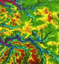
Dr Scott said that the tool is also able to show how different land structures affect the spread of a bushfire.
“The good thing about the three-dimensions is that the modelling of the fire shows how slope affects the speed,” she said.
“So when it gets to the top of a ridge, for example, it’s really roaring along because it’s exposed to the winds, and then it travels more slowly along the lee side of the ridge, so it’s very accurate in the way that it portrays fire.”
“We demonstrate to them that even if council were able to keep up to the date, and we can’t because of the weather, (or) keep up to schedule with all those burns that are listed, in the event of the scale, it wouldn’t make any difference.”
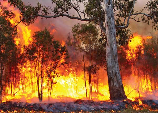
California’s deadly blaze
In America, the tool is used mostly by firefighters to plan tactics to deal with fires, Dr Scott says. Last November, the Camp Fire in Northern California was one of the most destructive wildfires in the state’s history.
Simtable was able to simulate the footprint and timelines of the deadly blaze, which took 88 lives and destroyed almost 19,000 structures.
“When you run the simulation you can see why, because it moved in such a way that the embers were spotting 20km ahead of the fire front and one town… ended up being caught between two fronts because of weather conditions,” Dr Scott said.
“What we’re saying to people in Ku-ring-gai is this could happen here. This is what you need to prepare for.
Simtable is also being used by the Victorian state government.
Comment below to have your say on this story.
If you have a news story or tip-off, get in touch at editorial@governmentnews.com.au.
Sign up to the Government News newsletter
Related stories

One thought on “Simulator tool shows how bushfires spread”
Leave a comment:
Most read
Scathing report finds little has changed at PwC
Qld council welcomes progress on massive battery system
Inquiry to consider how federal govt can address councils’ sustainability issues
‘Local’ procurement turns out not to be so local, committee hears
Another report finds local government falling down on cyber security
I didn’t get to read the whole text but I bet it would tell the world what is happening to our earth and what we need to do to fix it.