Government agencies and local councils are now increasingly routinely relying on Geographic Information System (GIS) technology to help them plan for disasters, expedite rescues and target clean-up and reconstruction efforts, but for policymakers there’s an ever present budgetary question as to whether they make a real difference reducing damage and saving lives or are just a ‘nice to have’.
The answer, based on recent evidence, seems to be that the technology already earns more than its keep, a situation that strengthens the case for greater government investment ahead of the annual allocation of state and federal funding.
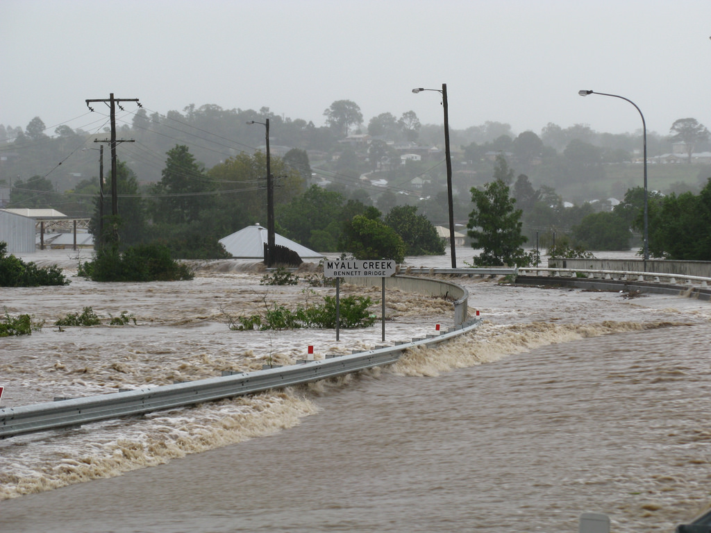
Agencies involved in battling the recent NSW storms and flooding used GIS to provide live public safety announcements and a live storm data by integrating different sources of information. For example, the Bureau of Meteorology flood gauges were integrated with the websites of local councils and public safety agencies such as the State Emergency Services.
Disaster Management Specialist for GIS company Esri, Mark Wallace, said GIS was excellent at bringing together different data sets and visually depicting a huge amount to make it easier to understand.
“It creates a complete operating picture that provides situational awareness,” Mr Wallace said.
“It means better decisions are made because there is only a finite set of resources that they [councils and government agencies] can use to respond to these events.”
He said GIS helped agencies and councils plan where to deploy their resources before a natural disaster happened by testing out likely scenarios.
For example, fire services could plan where to send scarce swift water rescue teams by working out the likely locations of the most serious and fast flowing floods – the kind that wiped houses off the map in Dungog, NSW.
He said coastal councils often used it as a tool to try to predict the damage caused by floods, cyclones and storms.
GIS can show the people disasters will be likely to affect, how many people will be hit and the demographic make up of a community, as well as planning evacuation routes and how to engage residents.
Bundaberg Council in Queensland uses their GIS to help residents to plan their own evacuation routes with maps that can show expected inundation, water velocity and depth.
“The more prepared we are for a disaster, the more we can further improve response and recovery efforts, reduce the loss of property and more importantly life,” Mr Wallace said.
Predicting the likely impact of natural disasters goes hand in hand with trying to reduce their impact, “preparedness” as it’s rather clunkily known in disaster management terms.
GIS can help test out harm reduction strategies, like building a levy or burn-offs in bushfire-prone areas, and it can also keep track of their progress.
“What happens if you build a levy bank? You can see it saves 100 houses from being flattened but downstream you have then got 1,000 more flattened so that’s not a mitigation strategy,” he said.
GIS again comes in handy once disaster has struck.
Reconstruction efforts after the NSW floods or the Queensland cyclone have be aided using mobile devices which record the damage done on the ground and immediately communicate this to councils or other organisations’ GIS.
Mr Wallace said Queensland was the first state government to do this during the 2008 storms, where the state used this information to plan outreach programs, rebuild infrastructure and help people back on their feet.
A recent Australian and New Zealand Disaster and Emergency Management Conference was focused on how GIS can mitigate, plan for and clean-up after natural disasters.
There was much discussion too about how GIS was moving on from being merely reactive to events to helping to put in places measures to lessen the impact of natural disasters.
“GIS has typically been primarily focused on the resource phase of an event but we’re seeing it become used more and more in mitigation, prevention and preparedness. We’re starting to see GIS move into that space and being expanded from the technical level more into senior management level,” Mr Wallace said.
He said senior managers were using it to get a quick picture of what was happening on the ground, particularly useful for responses to the media.
GIS could be used to learn from past natural disasters and any mistakes made.
“Using GIS technology, emergency personnel can capture, map and analyse data from past disasters to make informed decisions around future community awareness and prevention strategies.
He said this could include creating early flood warning systems or developing interactive smart maps to educate the community in the lead up to bushfire season.
Queensland Parks and Wildlife has used it to identify bushfire-prone areas and plan hazard reduction burning. It can also be used to inform building codes and where best to build houses.
Another development GIS was responding to increasingly was the public’s need for real-time information while natural disasters were happening.
All three tiers of government use GIS extensively including the SES, ambulance service, fire service and the Attorney General’s Department. Local councils have traditionally used it for asset management but they using it more widely now as part of their disaster management plans.
Comment below to have your say on this story.
If you have a news story or tip-off, get in touch at editorial@governmentnews.com.au.
Sign up to the Government News newsletter
Related stories

Most read
Scathing report finds little has changed at PwC
Qld council welcomes progress on massive battery system
Inquiry to consider how federal govt can address councils’ sustainability issues
‘Local’ procurement turns out not to be so local, committee hears
Another report finds local government falling down on cyber security